Sfântul Gheorghe
The St. George is reached by ship (Banat) or a catamaran, but both have a fixed schedule, which you can see on the website of the river station Tulcea.
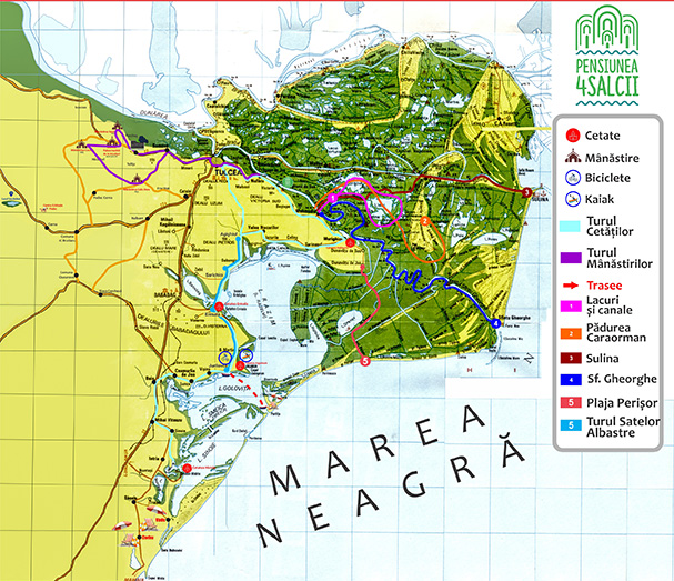
It is situated at the mouth of Sfantu Gheorghe and the Black Sea, at a distance of 120 km from Tulcea.
The settlement was mentioned in documents since the 14th century, referred to as the town of San Giorgio on a Map by genovese Visconti.
The main occupation of people is fishing, and this is their main source of income.
The city is important from tourism point of view because of the beach, Sakhalin island where there are several rare types of birds, Erenciuc channel where there are the only black alder trees in Europe. In recent years, rural tourism has a strong development and is practiced both in households and in guesthouses and hotels.
Economically, the town of Saint George is important because of the fact that here we obtain the highest amount of reeds in the country.
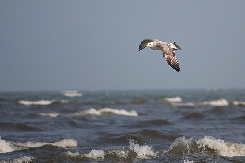
St. George has also one of the last wild beaches in Romania. With a stretch of 14 km, you can find villagers cattle coming to drink and a population of several dozen wild horses like those of Letea Forest, they are the last of their kind in Europe.
Points of tourist interest:
- beach consists of the finest sand on an impressive stretch.
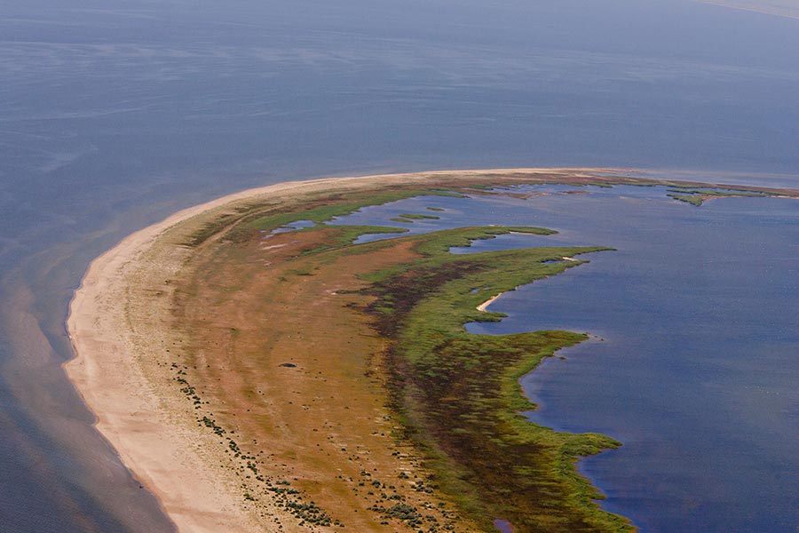
- Sacalin Zatoane nature reserve lies in the south of Saint George on about 21,000 hectares surrounding coastline. The area comprising the complex of lakes, ponds and ridges located in the southern part of the delta and consists of young sea-sand-banks, alternating with sandy shallow or isolated lakes;
- ANONIMUL Independent International Film Festival takes place in August. There are three sections: feature films, short fiction films and animated shorts.
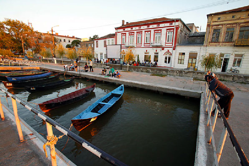
Sulina and Sulina Beach
Important port river and maritime Sulina is located in the eastern part of the Danube Delta, on the Western shore of the Black Sea (900 m. To its waters), the town located at the lowest elevation in Romania or 3.5 m at the mouth Sulina branch of the Black Sea.
The first document ( year 950) to Sulina, it is a document of Byzantine Emperor Constantin Porfirogenetul - "The Administrando rule". A Turkish document from 1745 talks about the existence of a lighthouse, which locals used to care for and even took care of raising the necessary lighting wax. It is also spoken in other document about a diffrent beacon probably around Sulina in 1802. Another document of international law, which nominates the port of Sulina
river - sea and lay the foundations for free navigation on the Danube is the Convention Russo - Austrian completed in St. Petersburg in 1840.
Arrangements undertaken by the project engineer Ch. Hartley to rectify Sulina branch led development of the port and the central mouth of the river. In 1856, the Treaty of Paris established the European Commission Sulina
Danube (CED), giving the city the status of neutrality in times of peace and war and free port status, allowing rapid economic development.
World War leads to the dissolution of CED in 1939 and loss of neutrality. In during the 2nd World War, Sulina is a military strategic point, being seriously affected by the bombings. It will fall under Soviet influence after the end of the war.
Access to the city: Accessible only by ship.
Points of tourist interest:
- Church - St. Nicholas, built in 1863-1868, restored in 1923. Orthodox Cathedral St. Nicholas, built in 1933-1934, in Byzantine style;
- Palace of the Lower Danube Commission - secular architectural monument, built in 1860 by the European Commission of the Danube, in neoclassical style;
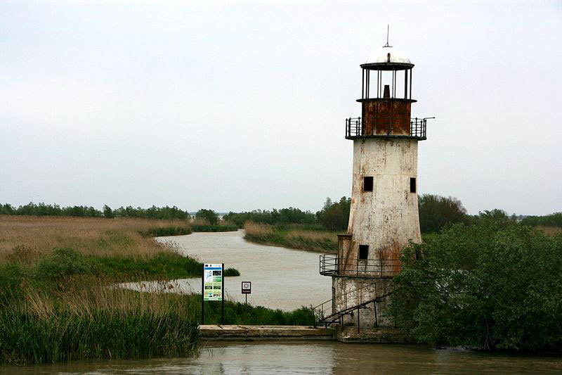
- Old Lighthouse - historic monument, was built in 1878, then it was rebuilt twice. At that time point is near the Danube flows into the sea. Today it stands at over 1.5 kilometers inland. Emits a fixed white light visible on a clear night from about of 36 km afar. The light is placed in the focus of 27 parabolic mirrors made of polished metal;
- New Lighthouse - Objective of secular architecture. The headlamp is a new modern building height of 59 m. It was built in 1982 as a maritime lighthouse;
- North breakwater lighthouse - built in 1887
- Beach - the beach has a width of about 100 m, decreasing to the south and a length of about 4.2 km. The sand is fine-grained. The beach is equipped with toilets and showers and is located 2 km away from the city;
- Maritime cemetery - a set of tombstones;
From Sulina you can go to Letea, Lake Light, Red Lake and Lake Puiu.
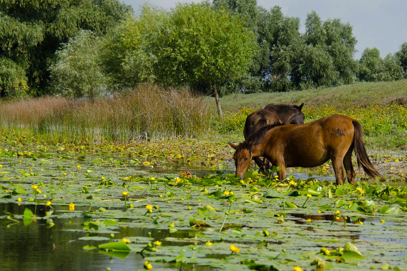
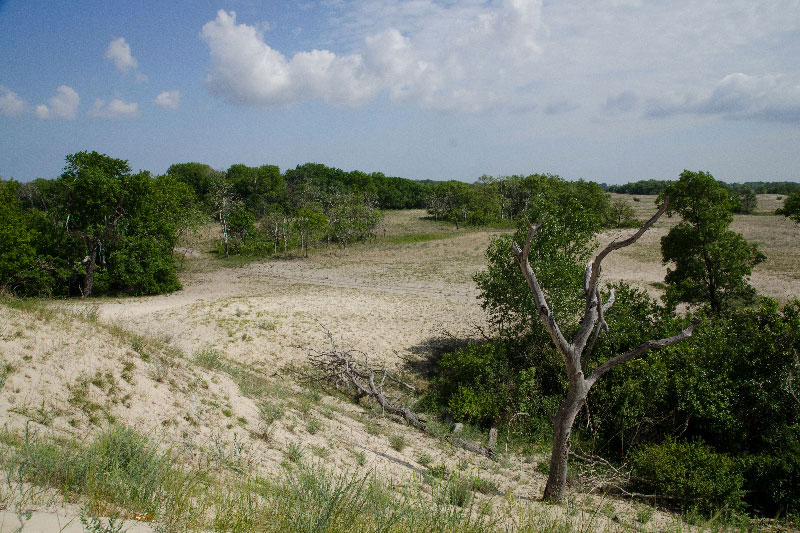
Letea Forest
Letea (2825 ha) is located in the north of the Delta, east of the village C.A. Rosetti. Strictly protected area covers only part of the total area of forest, part of which was placed under protection since 1930 and nature reserve since 1938.
Forest has developed in the form of flat strips "hasmacuri" in the spaces between the dunes and meadow is made of oak, gray oak, white poplar, ash meadow, white lime. After some decades, a large flood dug a channel edge and has allowed a salt water source to breathe and form a puddle in the sand here. It is like a mini- tekirghiol lake formed naturally in the 70s, is very salty, but extremely clean. As a sign of gratitude towards God, locals built a blue cross. Beside her, they appeared some bushes, that offer good shade for tourists.
A feature of the forest is the abundance of climbing plants: wild vine, hops, berries and tendril not least Greek liana (Periploca graeca), that gives the forest a Mediterranean appearance. Also, there have been identified
over 2,000 species of insects, sand viper (Vipera ursinii), eagle (Haliaeetus albicilla) - which nests here, three species of falcon, crow, etc.
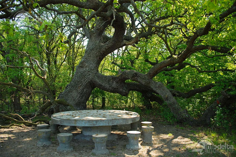
Caraorman Forest
Caraorman Forest - 2250ha: Caraorman Forest occupies the Caraorman hill located in the south of Sulina. Protected area comprises the biggest sand dunes of the delta and Caraorman Forest.
Caraorman Forest: declared in 1940, a natural monument is an oak forest (over 30 m tall), ash, poplar, with bushes and vegetation climbing the Mediterranean: vines that reach 25 m and climbing plants such as : beef
wild vine, ivy, hops, curpenu. Here are the biggest oak in the Danube Delta, with an age of 400 years and a circumference of four meters, oak called "The Kneeling Oak" because branches that have spread to the ground.
Legend has it that many centuries ago, in Crisan, people were preparing for big wedding. Beautiful daughter of a Romanian stray in Delta marry a Cossack warrior, which was proverbial for his bravery. It was peace and harmony among nations
who lived along the shore of the water ...
But there is a big trouble. Before giving her heart to the brave Cossack, the girl declined a turk that proposed to her before ... Angry, the turk waited for the right time for revenge ... When men departed from the village of Crisan to make preparations
for wedding, the turk and some of his pals stole the bride.
Knowing that they will be prosecuted, they hid in the woods not far from Fountain Hunters, as locals call it today. Even so, the mighty Cossack and his brave companions tracked down the thieves. It started a fight to the death
which had not been seen ever in the Black Forest. The Turks were killed one by one, many of them killed while kneeling in front of Cossacks and demanded mercy of Allah. Cossack saved the bride and then there was a great wedding.
At the spot where the Turks lost their lives, shortly after the battle sprang am oak. It is said that because it was soaked in the blood of the turks the oak took the shape after which its name was given: The Kneeling Oak.
In this forest were seen nesting white-tailed eagle, the forest protection ensuring and protecting of this species. What distinguishes Caraorman from Letea is the lack of the Greek liana and steppe viper.
Sand dunes near the village - unique in the country, which often exceed 7 m in height, reaching up to 9 meters high.
Jurilovca Village
Town in Tulcea county, near Lake Razim. The villages of the commune are: Jurilovca Salcioara and Visina.
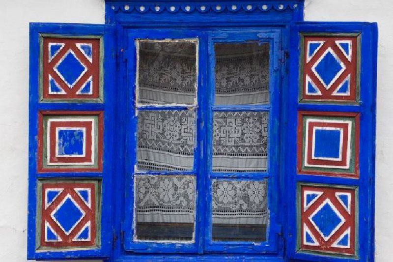
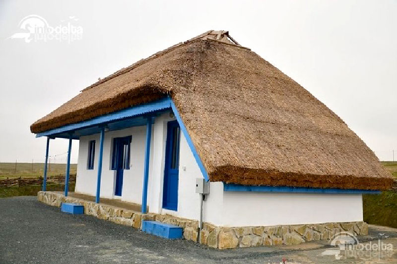
The first mention of the village, we have a Russian map (1828 - 1829). Currently in Jurilovca village is the largest fishing community in Delta, collector and fish processing, and a point of tourist attraction. Russian "Lipovans" homes
also shows certain features, facade colors are generally white and blue, and the roof is made of reeds. Lipovenian bath is a traditional installation - a separate building to house itself; traditional bathroom
or before major holidays it was almost a ritual.
How to reach Jurilovca The village is crossed by the county road DJ 222.
Points of tourist interest:
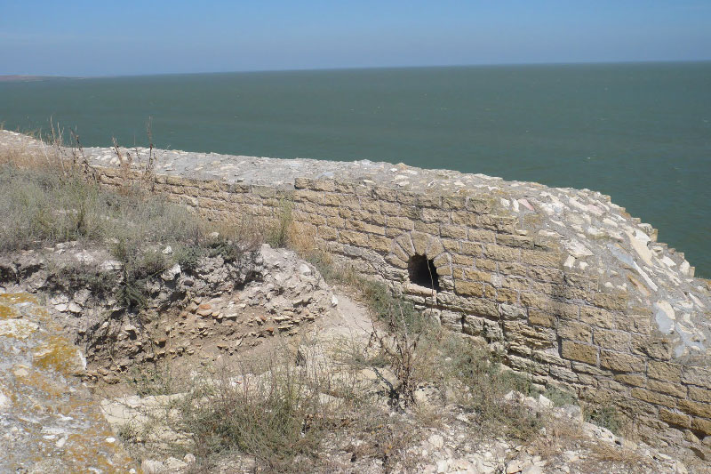
- 6 km from Jurilovca village on the banks of Lake high and steep, was partially uncovered and restored ruins of the Greco-Roman fortress Argamum;
- From Jurilovca "Gura Portitei" can be reached by boat, a holiday village situated on the narrow strip of land between Lake Golovita and the Black Sea.
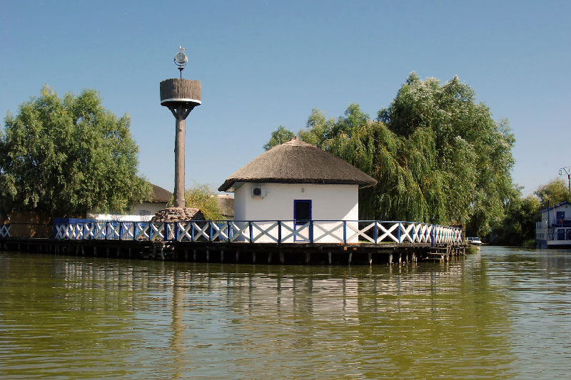
Gura Portitei
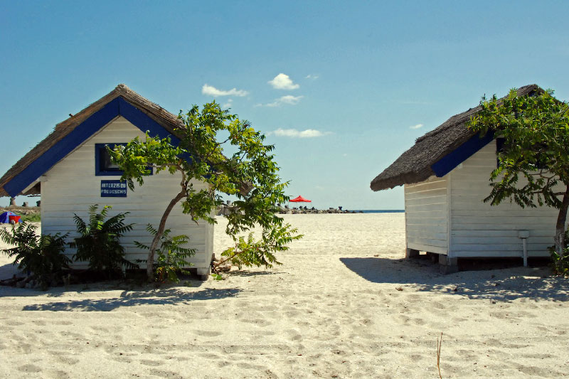
Gura Portitei is a paradise for those who dont enjoy the modern look of the Romanian coast in recent years. A Strip of sand stretching between the Black Sea and Danube Delta Golovita Lake is a fishing village
turned resort, dedicated to those who want to know a beautiful virgin coastal area of the country.
Gura Portitei is located 50 km from Tulcea is a relatively easily accessible destination for lovers of the Delta, but more challenging for tourists who soar for the first time in this part of the country.
You can travel to Gura Portitei either on land or by boat.
To ferry to Gura Portitei you must reach Jurilovca village first, on the road from Constanta to Tulcea, a road that is presented flawlessly.
Gura Portitei ferry leaves 3 times daily at 9, 14 and 18, and the trip takes about an hour and a half, and you will have to pay a fee of 30 lei per person. Seasick people should be advised that they go 16 km offshore. To everyone else
this way to arrive is a joy and a unique opportunity to admire the beauty of the Danube Delta on the way to the coast.
An alternative is a much faster boat than 8 persons the price is around 300 lei.
Tulcea City
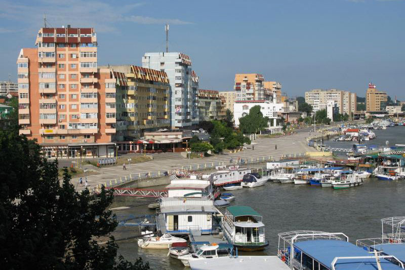
Tulcea is located in Tulcea County, the capital district of the same name, the second most important city in Dobrogea.
Tulcea has an area of 14 square kilometers, a population of about 100.000 inhabitants. The name of the town Tulcea is documented quite late was first mentioned in documents of Diodorus of Sicily century
3 BC as the Aegyssus.
The first document that mentions the name "Tulcea" is the travel diary of 1506 the consul Andrei Taranowski. Since 1595, the city will be known as Tulcea, being found on a map drawn up by Paolo Giorgici the Genovese.
During the 70s and currently Tulcea has experienced continuous economic and social development, the second most important city in Dobrogea.
Tulcea is bordered on one side with the youngest land of Europe (alluvial Delta) on the other hand with some of the oldest mountains of the planet (Macin, massive Hercynian age about 400 million years).
If you look at the city from Aegyssus old hill where today is Independence Monument, off the side of the Danube, which is built on the banks of the city seems a double gate; port is the one that provides entry on the part of Delta water in wonderful ways.
Many plant and animal species have also represented important natural resources, economically exploitable which attracted people to these places in the
ancient times.
Slopes of the seven hills on which Tulcea was raised make of a natural amphitheater opening to the Danube. Danube scored here a big loop at a rate ranging between 2,000 and 18,000 cm / s and a maximum depth of 34 meters in front of "Delta" hotel.
Points of tourist interest:
- Museums: Museum of Art, Museum of Ethnography, Museum of History and Archeology Ecotourism Center "Delta" traditional fishing village;
- Churches: Cathedral, Greek Church, Church Clock, cathedral mosque "Azzizie"
- Civic Square;
- Fortress Aegyssus
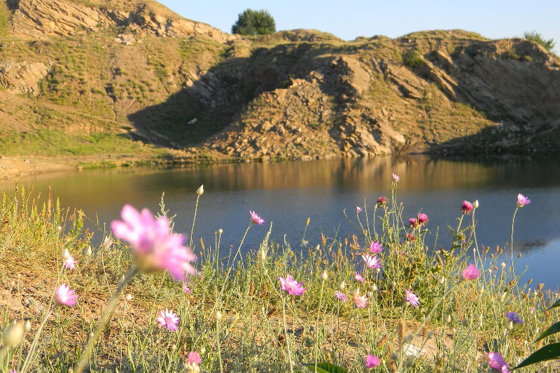
Lake Iacobdeal
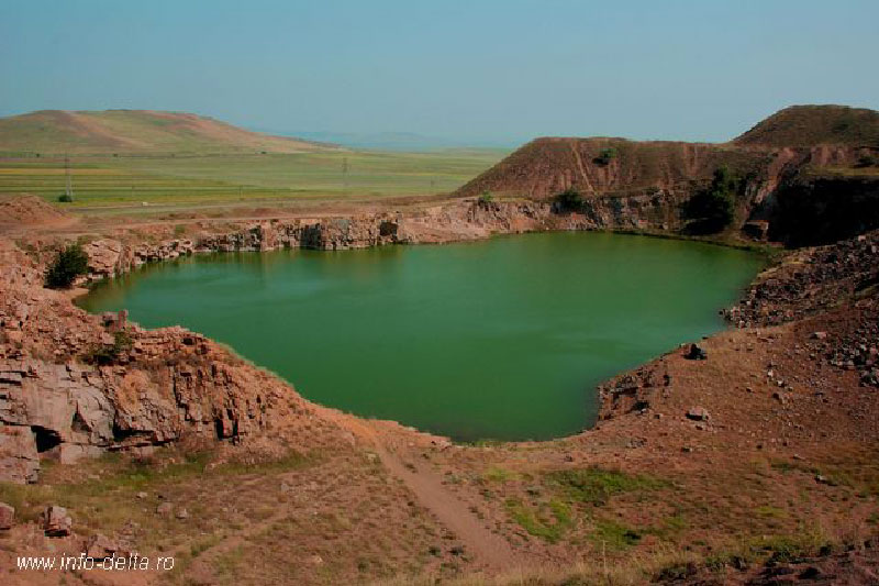
Located near Turcoaia, Tulcea, Iacobdeal Lake, a man-made lake, formed in an old granite quarry operated decades ago. Dynamiting one of the galleries, made ground water to flood the place and thus was the lake created.
Locals call it "Fountain" and say it is not more than 20 meters deep and covers dozens of equipment left behind after quarrying.
Its emerald color, clear water and bucket shape creates a unique image, resembling a glacial lake, which makes this place unique. It is surrounded by glazed walls of granite, steep banks and is said that big fish are living in its depths.
The lake has no connection with any other aquatic unit. In it there is no water flows flowing and has no drain to the Danube. Lake water supply is just and groundwater and precipitation.
Near the lake there are visible traces of buildings used in the past, the time when this work successfully granite quarry. Located in Macin Mountains, the lake is not easy to find because there are no signs. Residents are those who guides you to
this corner of paradise where bathing in summer is the main sport.
Marcel Țăranu, a professional diver purchased this place years ago. However the owner did not charge those who venture to bathe in emerald water, or to
who want to feel senziţiile countries and using the trampoline to jump ten meter gap before reaching the water.
Access to the lake can be also through a cave and giving the place a touch of adventure, magic of nature.
Medieval Fortress Enisala
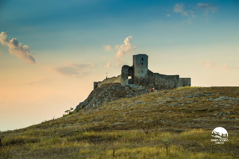
2 km east of the village Enisala and 7 km from the town of Babadag, on a limestone hill which dominates the eagle nest area lakes Razim and Babadag, the ruins of medieval fortress Yeni-Sale (ENISA, Heracleea or Heraclia).
Fortress Enisala is among the monuments of military architecture from Romania, built in the Middle Ages with remarkable design planimetric system of fortifications, construction techniques, architectural elements. fortification
It was built in the second half of the century. XIV by an authority aimed at the Danube area. Based on constructive techniques, it has been hypothesized that only interested in the lifting of a fortress located in the fortification system
in Northern Dobrogea, oriented high traffic surveillance ships were Genoese merchants who possessed large sums of money earned from trade and monopoly holders were sailing the Black Sea.
Enisala fortification was part of the Genoese colony chain that encapsulate Delta cities - Chilia and Likostomion White Fortress at the mouth of the Dniester Caffa in southern Crimea. Between 1397-1416 the fortress was part of the system Enisala
defensive Romanian Country during the reign of Mircea the Old. After the conquest by the Turks in 1419-1420 Dobrogea, the city was installed an Ottoman military garrison.
Later, because of the Turks conquered much beyond the mouth of the Danube to White Castle and Chile (1484), and the formation of beads of sand that separates Lake Razim from the Black Sea the fortress was abandoned in the XVI century, because of the
Turkish strategic and economic interests.
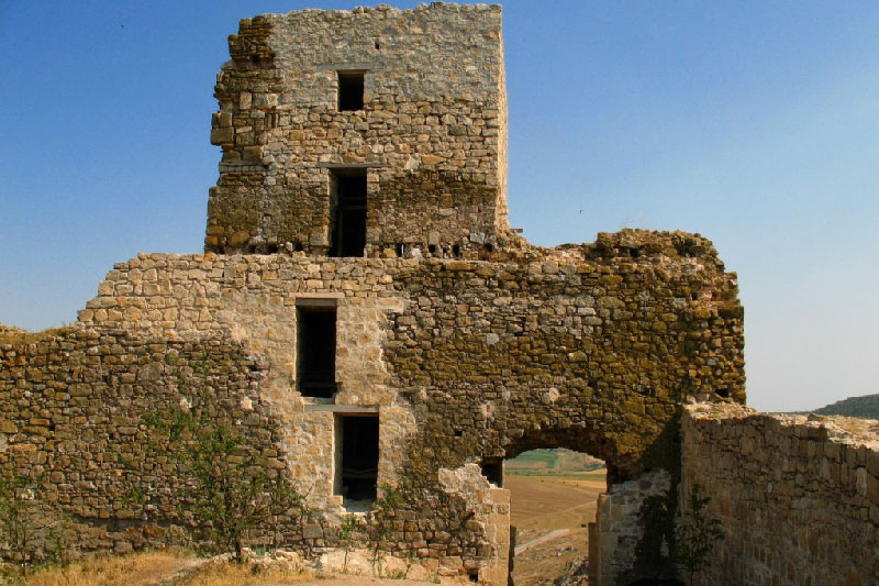
The inside walls of the fortress is preserved for the most part at a height of 5-10 m and can be easily observed from far away. Precinct West southwest was built on the steep headland. The fortress has the shape of a trapezoid
or irregular quadrilateral of side West southwest almost entirely destroyed, over 100 m long; eastern and northern sides are approx. 50 m, while the south is about 30 m. The inside wall is thick 1.50 m - 1.85 m, shows the outside
eight defense towers with three, four and five sides
Both the enclosure wall, and towers are built of limestone carved, shaped, cubic shape, small and medium enterprises. Entry (on the south) was made through a gate opening very high, fitted with double arch
and defended by a massive pentagonal bastion. The second inner wall of the fortress located on the north-east is equipped with square and triangular towers. After 1991 the fortress walls breaker weather were restored Enisala
becoming an important landmark.
The fortress orgininal name was not preserved and the current name of the village, and thus the monument comes from the Turkish word Yeni Sale which means "new village". Sec. XV when Dobrogea was under Ottoman rule, the town was populated by Romans. research
archaeological point "Church" led to the discovery of a cemetery century. XV-XVIII awarded the Romanian Christian populations.
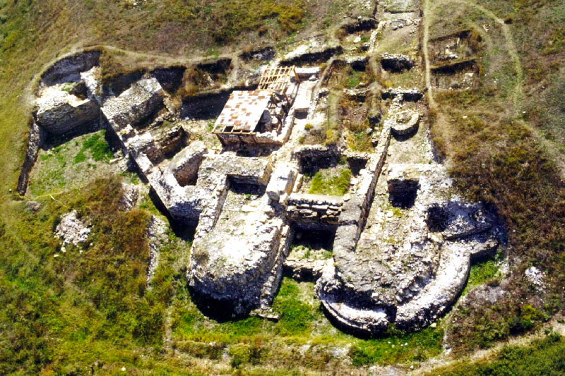
Fortress and Monastery Halmyris
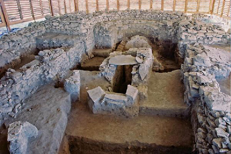
Halmyris Monastery is at a distance of about 2 km from Murighiol Village on a paved road towards Dunavatu De Jos Village immediately after Halmyris ruins.
Monastery dedicated to Saints Martyrs Epictetus and Astion (oldest holy relics discovered in our country, since 280 AD) is celebrated on July 8. The second patrons, Saint Priest Montanus and his wife Maxima is celebrated
on March 26.
Currently, the monastery is under construction, the cells being finalized. As a project, the church will have a total height of 37 meters and will be equipped with five towers. As elements: stone basement (now completed), church steeples on the back (not on front, as we are used to), portraits of religious figures on outer walls.
Cetatea Argamum
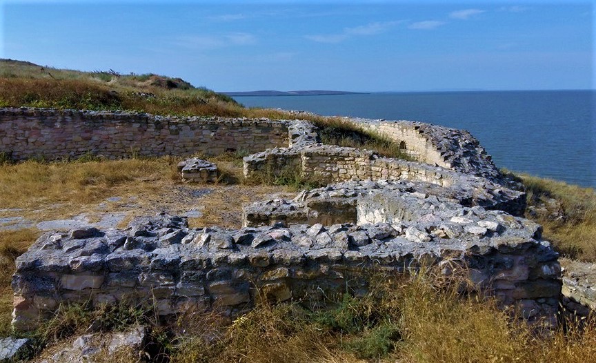
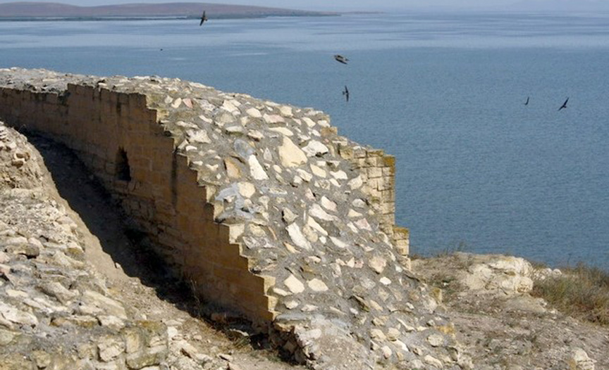
The Argamum fortress is located on the shore of the Razelm - Sinoe complex, 20 kilometers from the St. Georges arm, 40 kilometers north of the Histria fortress and 7 kilometers from the Jurilovca village (Jud Tulcea). Access is through Jurilovca, from where you can reach the archaeological site on a land road. The fortress was founded by the Greek colonists coming from Asia Minor by the 7th century BC. The fortress is the first settlement on the territory of our country mentioned in the ancient writings. The excavations have revealed traces that date back to the Bronze Age.
At present, the Argamum fortress extends about two hectares and a half away, being the traces of the edifices of the Roman age. Together with the island of Bisericuta, which is a visitor, the site is also attractive through the deosibet place where it is located, which is in the sphere of the Delta Biosphere Reserve. The eroded cliffs of Razelm offer a spectacular scenery and the possibility of riding in the circuit over the shore and beside the water.
The Argamum Fortress (in the Greek Orgame) was located by Vasile Parvan in 1916. Legend says it is one of the places where the Algonuts stopped on their way to finding the golden rope. Every year archaeological campaigns bring out new elements. Researchers are trying to prove that Argamum is older than Histria.
Besides the unique archaeological landscape, Dolosman Head, where the Argamum fortress is located, benefits from an exceptional landscape, which can increase its tourist attractiveness. Once upon a point on the ancient trade routes linking the Mediterranean basin, now just an isolated place where tourists can get by, this extraordinary place will enter the touristic circuit with the creation of a paved road between Jurilovca and Argamum.


